
Reading the Signs
A Gulf Coast Florida Boater’s Guide to Markers
By: Kristen Ordonez
Cruising Florida’s Gulf Coast, whether you’re running the Intracoastal Waterway, slipping through a pass, or heading offshore, means constantly reading the water. And out here, your most important language isn’t spoken or written in the stars — it’s colored, shaped, and floating in the form of markers and buoys. These forms of boating communication aren’t just suggestions. They are the difference between a smooth ride and running aground.
What Markers Actually Do
Think of these markers as road signs for the water. These floating markers tell boaters where the safe channel is, where hazards may be hiding, and what rules need to be followed. Similar to how drivers need to know what the signs mean before getting a license, if you ignore these while out on the water you risk the safety of yourself and others, not to mention the safety of other boaters. Even if you're familiar with your local waters, it’s important to pay attention to markers, buoys, and any changes.
What Markers Mean
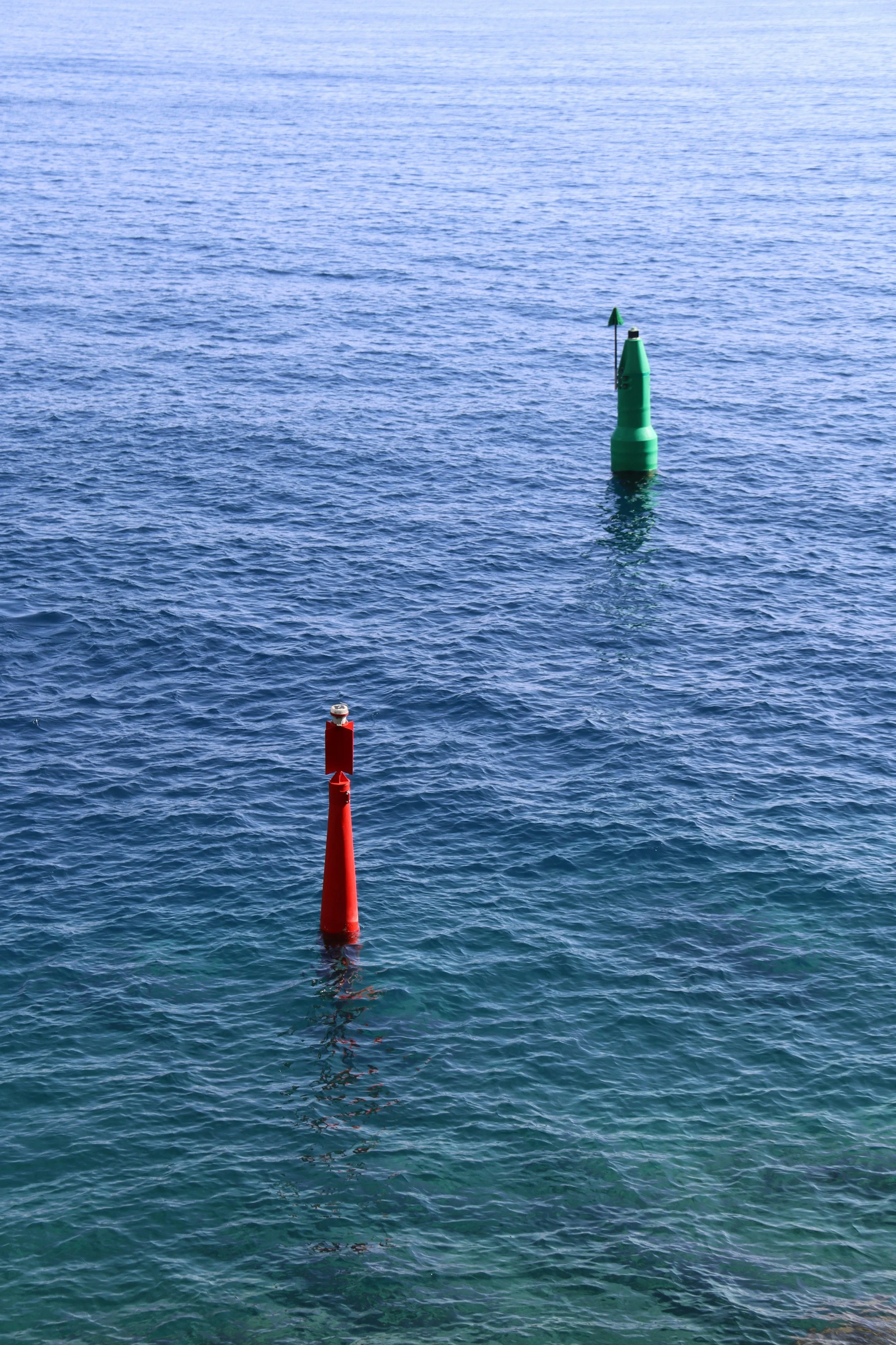
Florida and all U.S. waters use the International Association of Lighthouse Authorities (IALA) system. That means one golden rule: Red, Right, Returning.
When you’re heading in from the Gulf (or moving inland), keep red markers on your right (starboard) and keep green markers on your left (port). And these markers don’t just rely on color — they use shape and numbers too.
Red Markers / “Nuns”
Cone-shaped
Even numbers
Mark the right side of the channel when returning
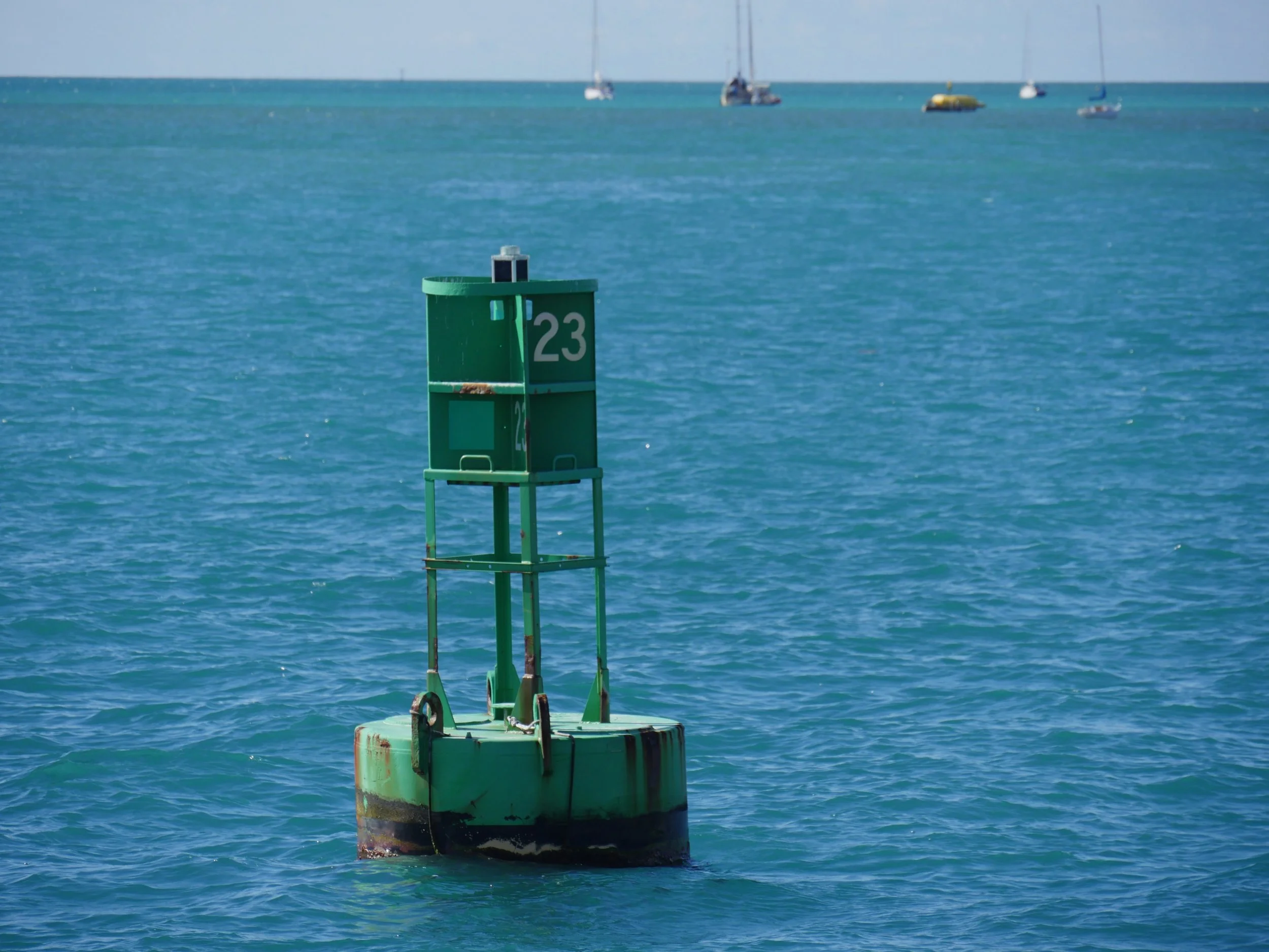
Green Markers / “Cans”
Flat-topped / cylindrical
Odd numbers
Mark the left side when returning
Numbers increase as you head inland—helpful when navigating long Gulf Coast channels or rivers.
Now here is where Florida gets interesting: along the Gulf Coast, the Intracoastal Waterway overlays standard markers with yellow symbols. The yellow triangles and squares tell you which markers belong to the ICW route. These symbols OVERRIDE the standard red/green navigation for ICW travel. So if you’re running the ICW from places like Tampa to Fort Myers, follow the yellow, not just red and green.
Beyond Red & Green: What Else You’ll See
Safe Water Markers
Spherical buoys or pillars
White with red vertical stripes
Found at channel entrances, mostly in the center
Meaning: You’re in safe, open water
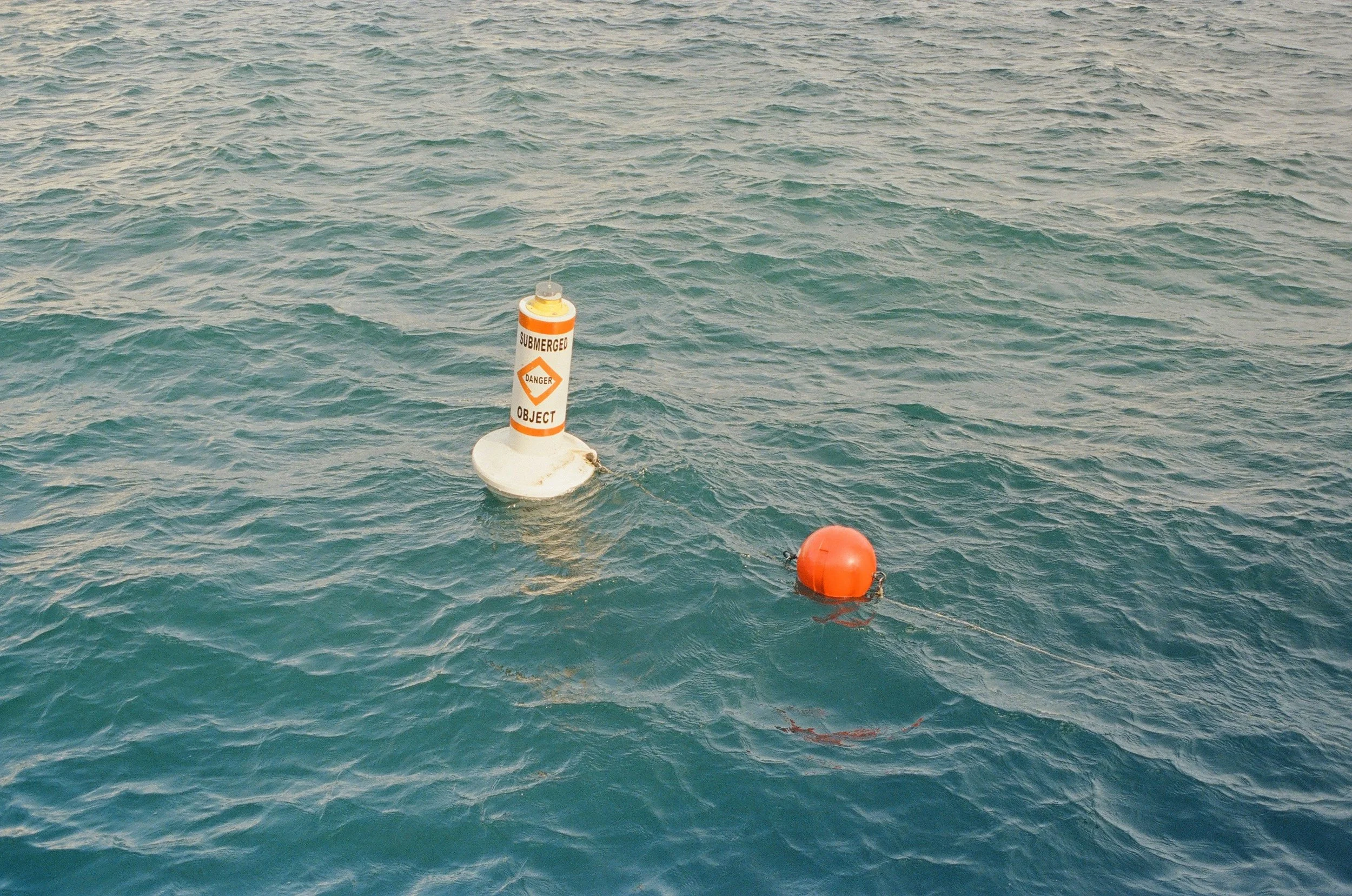
Danger Markers
Black and red bands
Mark isolated hazards (rocks, wrecks)
Meaning: Safe water exists all around them
Regulatory Markers
Circle = Restricted operations/controlled area (slow speed / no wake)
Orange diamond = danger/hazards
Diamond + X = Do not enter
Square = general information like directions, distances, marinas, etc.
So when you’re coming back from offshore fishing into a Florida inlet, be sure to follow these general guidelines:
You line up the channel
Spot red and green markers
Keep red to starboard
Watch numbers increase as you head in
Take notice of a white/red buoy marking safe water at the entrance
In a place where sandbars shift and water clarity can deceive you, that knowledge isn’t optional; it’s essential. Markers may feel overwhelming at first, but they follow a simple logic. Master the system, and suddenly the Gulf Coast becomes far more predictable.
Green buoy photo is Adobe.
Red & green buoy Photo byShalev Cohen onUnsplash
Submerged object hazard buoy Photo bySichen Xiang onUnsplash